|
|
|
|
|
kearsarge pass - september 2004 |
back to backpacks |
|
2 days: 28 miles john muir wilderness/kings canyon national park, california september 18-19, 2004 |
|
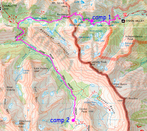
day 0: onion valley trailhead to as far as we could get by dark 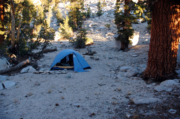
We checked weather reports and obtained our permit. Dr. Howard and the Dweebs said a cold front would come through Sunday to Monday. Local sunset was 6:30, so we made our way to Onion Valley and readied the packs as the hot sun slipped behind the western wall. We began hiking at 5:40 marveling at the nice, firm, steady trail compared to the awful Shepherd Pass trail which we had hiked the previous weekend. We passed Little Pothole Lake, then lovely Gilbert Lake, then at Flower Lake we decided it was time to look for campsites in earnest. It was getting dark quickly and soon we would be unable to find any good sites. We continued up the switchbacks through lovely forest until we came upon what looked like a decent clearing. Upon quick inspection we found that this camping spot stretched behind boulder and trees into a sort of "suite". 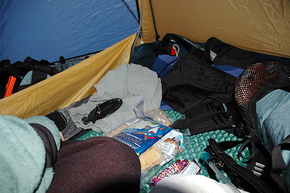
We dropped our packs at 7:15 and set up camp in the cooling air of dusk. Temperatures in the 50s and 40s were a welcome relief to the heat wave we had been experiencing in Pasadena. Since we had already eaten dinner on the drive up (Taco Bell packs some good calories), we stashed our bear canisters and unpacked our sleeping bags for a good night of sleep by 9 pm. Below: this is what happens when you unpack your backpack...
day 1: off the switchback to best camp north of forester pass via kearsarge pass We must have been tired because we didn't wake up until 6:00. Actually, I woke up at 2:00 and went out to pee, then felt so much better I fell back asleep for four more hours. We were slow to start until we realized the rising sun was poking through the trees and onto our tent. We left camp by 7:40 and continued up the trail to Kearsarge Pass. It was a cool 40+ degrees and despite the full-on sun above treeline, the brisk wind off the pass kept things chilly. We arrived at the pass by 8:50. 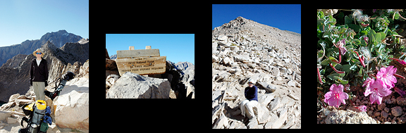
The western side of Kearsarge Pass is considerably steeper than the pleasant eastern side. We made a quick descent into the basin admiring the jewel-like lakes that dotted the landscape. Below you can see some of the Kearsarge Lakes at the base of the Pinnacles and to the right is Bullfrog Lake. 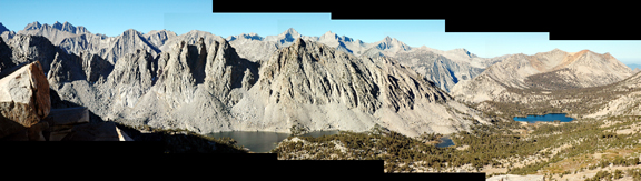
We stopped for refueling at Bullfrog Lake where camping and stock were prohibited. Beyond the lake were a couple of pretty tarns which the trail skirted before the junction with the John Muir Trail. The temperature was perfect for hiking, but whenever we stopped for a break, we chilled quickly. 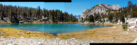
From the junction we dropped steeply into Vidette Meadow at 9600 feet. I hate losing elevation. We knew we wouldn't make it over Forester that day based on our energy levels and the 8 miles and 3800 feet to climb. So we plugged along up the valley to a campsite where we lunched and studied the map in the partial shade of the trees. Along the trail we encountered only one drift fence as opposed to the 2 or 3 we recalled from 4 years ago. Apparently some were removed, much to our delight. Beyond the junction with the Center Basin trail, we found our old campsite but decided to move on as I had recalled some better sites right at treeline. Below: the view from our camp. 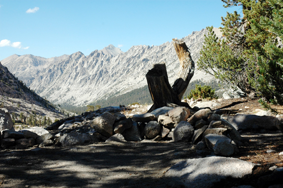
We sought water to pump, but all of the streams were at minimal flow or dry. Luckily, we found one with a tiny depression deep enough to fit our filter bob without stirring up a bunch of gunk. A group of three German backpackers passed by on their way toward Forester. Jeremy noticed they were cooked - lobster red. They had no idea. We got to camp by 3 so we had a lot of time for dinner and discussing our plan of action. We tried a new dinner (chicken pasta salad) which looks like vomit when you mix spelt pasta, pouch chicken (modern version of canned chicken), dehydrated vegetables, and packets of mayonnaise from NASA JPL's cafeteria (courtesy Trudi - thanks!) together. It tasted great for the first 5 bites, then it began to taste the way it looked. Should have brought tobasco sauce. As we tidied up our camp we noted some clouds forming at the north end of the valley. We'd have to watch for those the next day. Dr. Howard said the storm was due Sunday, not Saturday. 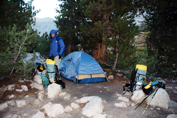
day 2: getting the hell out of dodge 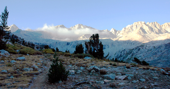
We woke at 5:30 and wondered at the condensation inside the rainfly. The humidity had gone up (it was still much drier than a normal day in Pasadena). How about those clouds? They would determine if we ventured over Forester Pass into the beautiful Tyndall high country. I went outside for a potty break and noticed puffs of clouds down valley racing from west to east scraping against the tops of the peaks. Ugh. Weather like this before sunrise doesn't usually bode well in the Sierra. I got back in the tent and we weighed our options. We could probably get over Forester without consequence, but what happens once we're over the pass? Our plan was to noodle around in the high country and explore Milestone Basin and get a peek into Cloud Canyon and see the Whaleback. None of that is much fun (or safe) in bad weather. Dr. Howard and the Dweebs said precipitation. That would be snow for us. Suddenly, it just didn't feel like vacation to me anymore. We could go back the way we came, or go over Forester, then over Shepherd Pass (remember, that trail we hate?) and hike out to the trailhead then hike another 4 miles to the Onion Valley Road and then have Jeremy hike 9 miles and 3000 feet up the road to the car. Up valley, clouds formed over the snow patches as soon as the rising sun hit them. 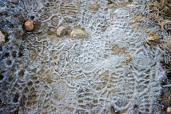
We got a late start at 7:20 after all of the discussion about what to do. On our way back down the trail, we noticed frost on the ground wherever water was seeping. We encountered a solo backpacker on his way up to Forester. He asked us if we had heard any weather news and we passed along the Dweeb report. He eyed the clouds above and said he would hopefully be below treeline when it arrived. We hoped so too. Close to Vidette Meadow we stopped to apply sunblock and chow on some jellybeans (I highly recommend Starburst Jellybeans - excellent pick-me-up). 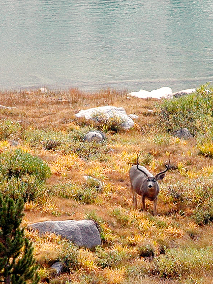
From Vidette we ascended steeply to the junction with the JMT and continued to Bullfrog Lake. When I stopped to remove my hat, we noticed a small herd of deer - almost a dozen, lounging on the banks of the lake. 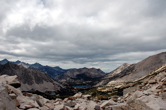
The clouds had been patchy and active, but now they began to blanket the northern sky. We hiked in alternating sunshine and shade. The winds were picking up too. As we rounded Bullfrog we opted to break for lunch a little further on in the hopes of putting distance between us and the front. Two pairs of backpackers coming down from Kearsarge passed our lunch stop. We proceeded up the switchbacks encountering three dayhikers who had visited the Kearsarge Lakes. The front ooched ever closer as we huffed our way up the switchbacks and across the final stretch to the pass. When we made it, the two sides of the pass were like night and day. Owens Valley glittered in the sun while the blanket behind roiled close overhead. 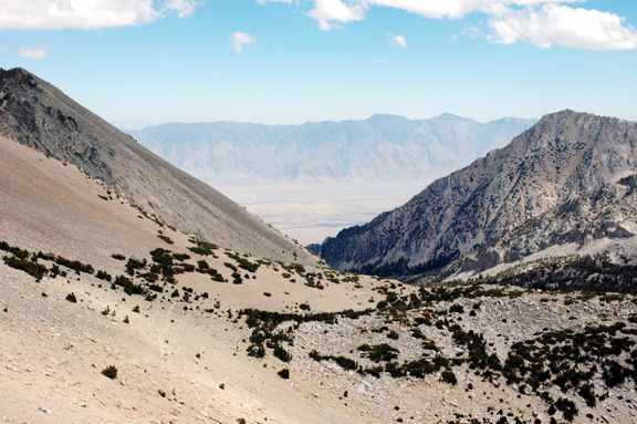
The gentle trail of the eastern side passed quickly under our feet. We met many day hikers on their way up, one even told us that we'd be delighted to learn that Independence was a balmy 80 degrees. The wind made it feel colder than 40 for sure. Down the switchbacks, we ticked off our progress with the passing of each lake - Big Pothole, Heart, Flower, Matlock... We got to our first camp in 50 minutes. The sun had disappeared for good. During a pause, I decided to whip out the camera (afterall, why lug it up there?) and get one of the many gurgling trailside waterfalls surrounded by the onset of autumn. 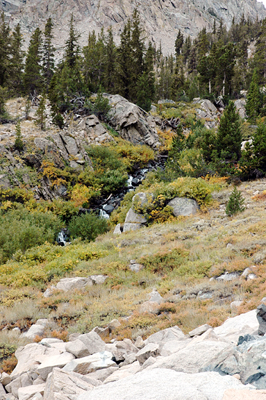
It took another 65 minutes to hike to the trailhead. It is when you are hiking downhill that you start to recognize how some switchbacks are just unnecessarily long and level. Of course, hiking up those switchbacks with heavy packs may elicit a different reaction. In the last 2 miles we were spat upon by rain and in the remaining half mile to the trailhead, mother nature tossed in some hail for good measure. Not to worry - the car was in sight and we were there by 3:10. On the drive down we admired the incredible cloud formations over Owens Valley and noticed the storm was more expansive than we had imagined (Mammoth got its first dusting of the season that day). The system spilled across to the White Mountains and into Nevada - it stretched beyond what we could see to the north. Driving back home we passed Mount Whitney which the storm had proceeded to engulf. I pulled out my knitting for the 4-hour drive home. 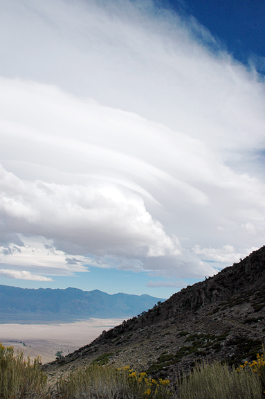
|
|
|
|
back to backpacks |
