|
|
|
|
|
high sierra - august 2000 |
back to backpacks |
|
6 days: 62 miles sequoia/kings canyon national parks, california august 21-26, 2000 |
|
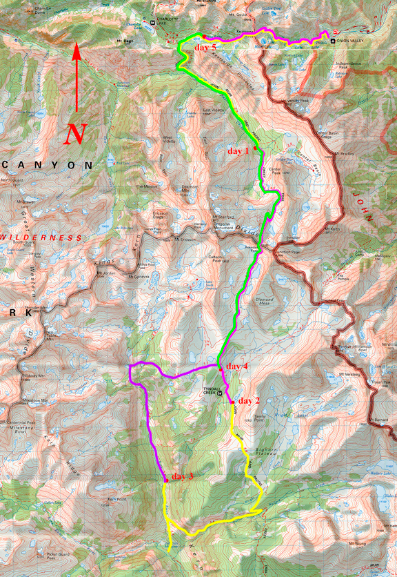
We arrived in sunny San Diego around noon on August 19th and ran some errands in town before driving up to Victorville to stay for the night. From Victorville (actually, Hesperia) we drove up Owens Valley to the town of Lone Pine to get our permit reservation changed. Turned out there was a troop of Boy Scouts hiking in the same day we wanted to hike in from the Kearsarge Pass trailhead - they had filled all 24 advance reservations for that day. We decided we would leave early in the morning to avoid the notoriously loud and obnoxious group of boys. They are not known for early starts and they are also not known for observing general backcountry etiquette. We drove up to the small town of Independence and headed west into Inyo National Park towards Onion Valley. They warn that it is a windy road that climbs quickly to its destination, but if you've ever driven the road to Mineral King, this one is a cakewalk. Below is the view of the eastern Sierra from the road. 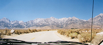
Once at Onion Valley, we secured a dusty campsite and sorted our gear. The air temperature was very cool, lower than 70F, but in the sun it was hot. We took an afternoon nap while the other campsites filled up. Our trips usually involve driving from sea level to the trailhead in the wee hours of the morning and starting the hike in by mid morning. This time, we made it easier on ourselves by spending one night at elevation to acclimate and make the morning start an early one. Below you can see up Onion Valley from the parking lot. 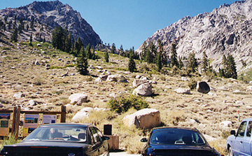
day 1: onion valley to jmt junction with center basin trail 
We hit the trailhead at 6:05 am, entering through the Inyo National Forest. The sky was glowing to the east over the very flat and low Owens Valley, but the sun would be another half hour before it reached us. As we rose above the parking lot, there was no sign of boyscouts. I took the picture of the trailhead sign the previous day knowing it would be too dark for my camera the following morning. It was chilly, but we grew warmer as we hiked up and as the sun caught us. It was not long before we entered the John Muir Wilderness. 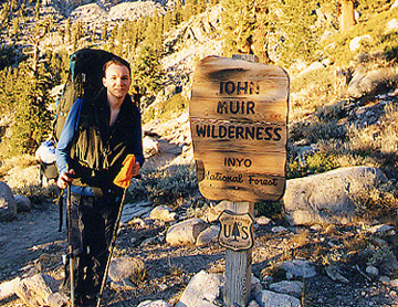
The climb up is really a series of benches upon which paternoster lakes are nestled. The trail switchbacks moderately and affords pleasant views of the lakes. My favorite is Gilbert Lake whose eastern lip abuts a rocky ledge with an apparent drop off to the sky. Much to our relief, we were past the peak of mosquito season and those that lingered were not aggressive. As we rounded Gilbert Lake, we passed a large group of students (turns out they were freshmen from Pomona on an orientation) doing their morning things in camp. 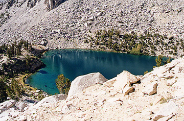
This is Heart Lake from the trail above. The color of the lakes in the High Sierra is striking. We learned there is some good fishing (golden trout) in a number of the lakes - but not all. Many people dayhike from Onion Valley to these lakes with a small backpack and fishing rod in hand. The trail lead up and around large knobs in the terrain until we reached treeline and could see Kearsarge Pass on the ridge. Once we arrived at the pass, we were greeted by three backpackers coming from the other side who were hiking out that day. We took a break for lunch and were joined by a young man who had day hiked up to see the pass, and two middle-aged men bringing a food drop in for their buddies hiking the John Muir Trail. Although the food delivery fellows were nice, they were pretty unprepared as they had no map (nor much of an idea of where they were going) and one of them was showing signs of altitude trouble. Before long, the group of Pomona students reached the pass and everyone else decided it was a good time to move on. It never fails to astonish me how very very stupidly freshmen men behave. Below is a panoramic from Kearsarge Pass at 11,800 feet. 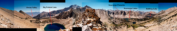
We descended the western side of Kearsarge Pass which is the boundary between Inyo National Forest and Kings Canyon National Park. Entering Kings Canyon, we noticed that the trail was steeper than the approach we had taken that morning. The trail dropped down to the basin containing beautiful lakes. We passed the spur trail leading to the Kearsarge Lakes. We could see one of the food delivery guys heading down that trail. At one point we stopped for a water break and turned to look back at the landscape behind us. The second food delivery guy was coming down the trail - this was the one having problems with altitude. I asked him if he was heading for Kearsarge Lakes and he said yes. We indicated that his buddy had taken the trail at the junction he passed. He seemed bewildered, but thanked us and turned around. We were starting to run out of water and decided to continue on and pump water at Bullfrog Lake. Here is a mosaic from the northern shore of the lake. 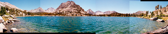
We rounded the northwestern corner of the Kearsarge Pinnacles and descended to a junction with the John Muir Trail (JMT). We headed south on the JMT dropping down to Vidette Meadow. We followed the trail up the valley, pretty much paralleling Bubbs Creek. I should note that these are pack trails, so there are a couple of drift fences to pass through, but more importantly - you will never lose the trail because it has so much horse shit on it. We took a break at a campsite with a bear box - but wanted to move closer to treeline for our crossing of Forester Pass the next day. We looked for the trail junction with the Center Basin trail, only to discover that it is not signed, but marked with a tiny cairn and a few stones lining the path to the east. The obvious campsites appeared on the right of the trail with the standard issue brown bear box. Two fellows were already setting up camp, so we chose a site further back. 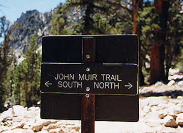
We were both tired and footsore. We set up camp and ate dinner while the sun drifted off behind the valley wall. Mosquitoes came out as evening fell, but they hovered clumsily in the air and were easy to shoo away (or kill - as I preferred). Jeremy took a picture of me enjoying my hot chocolate. Shortly afterward, we retired to the tent and passed out. 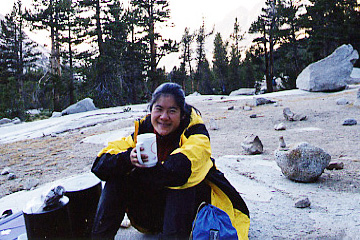
day 2: upper vidette meadow camp to tyndall frog ponds 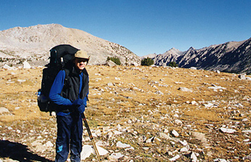
We got a later start in the morning than we had hoped and began hiking at 7:30. Our past experiences with passes (and running down passes with thunderstorms raging overhead) have inspired us to rise very early and make the pass well before noon. This would also pay off at the end of our trip. We were camped just below treeline in Upper Vidette Meadow and there were at least two other camps that hadn't risen yet. We quietly made our way up the valley past the stunted pines and onto a small plateau where we took a break to apply sunblock and have a snack. 
This is lake 12,200 and Forester Pass (unseen) is behind the dip on the right. We filtered some water at the lake outlet, had a powerbar and began the steady switchbacks leading up to the pass. On our way up, we were passed by a solo backpacker who was finishing up the John Muir Trail (starting from Yosemite Valley - a beautiful 210 mile trip ending at Mt. Whitney). This guy was totally impressive: decked out in black spandex shorts and shirt, great tan, great muscles, a huge white backpack and clearly from San Francisco. He was covering 20+ miles a day and just cruising along. He asked if we had ever crossed Forester before and we said no. He told us that the southern side is an amazing feat of engineering. Our curiosity was piqued. The approach to Forester from the north culminates in many short switchbacks until you see the sign that indicates you are leaving Kings Canyon and entering Sequoia. We didn't realize we had reached the pass until a couple at the top said, "congratulations!". They had camped at lake 12,200 (they reported a very windy night) and had been lounging about on the pass for a while. They headed down the south side while Jeremy and I took a picture for another backpacking couple on the pass. 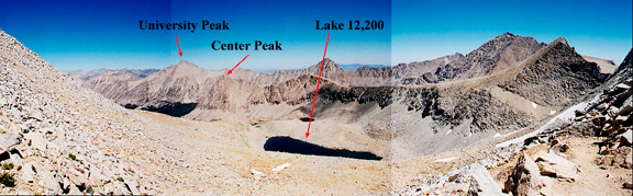
The views from Forester were incredibly rewarding, but Jeremy and I agreed that the best view we had seen was still from Black Rock Pass. Looking south (and down) from the pass, you could only see a very steep and rocky chute. I thought there was no way a trail went down that. 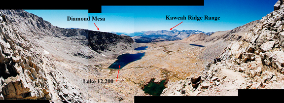
Here are our our token photos of the trail sign on Forester. One side welcomes you to Sequoia and the other welcomes you to Kings Canyon. We were now entering my favorite national park, Sequoia. 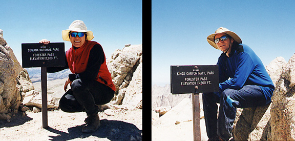
Once I rounded the bend and began switchbacking down the south side, I completely understood what our spandex friend was talking about. What an amazing trail. From the south side, you can't really see the trail unless you know what you're looking for and even then it is very well concealed. Seeing the chute below the pass, you would think there was no way a trail led up to Forester. We passed a lot of backcountry rangers doing trail maintenance as we switchbacked down to the Upper Tyndall headwaters. They were drilling and setting up explosives - it was very dusty and dirty work. We thanked them all as we passed by. After hiking on lousy trails in New England, I have immense appreciation for all of the hard work people have put into trails - especially in the Sierra. 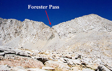
We took a break for lunch at the bottom of the switchbacks and admired the sprawling landscape before us. I don't know if this area has a name, but we just referred to it as the Upper Tyndall plateau. It slopes gently for a few miles to the south before Tyndall Creek cuts down and plunges to join the great Kern Canyon. We filtered more water (see picture to the right), deciding that the faster way to travel would be to carry a couple of liters at a time and filter as we needed since water would be plentiful along our route. The trail was mild and pleasant for a few more miles and we passed numerous marmots and pika among the boulders. I also saw the fattest marmot EVER - all of the inhabitants were getting ready for winter. We took our time admiring the points of interest around us since the weather was clear and the route ahead was gentle. 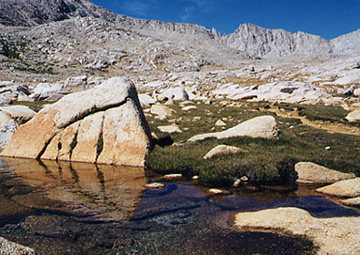
We arrived at some campsites just before the turnoff to the Tyndall backcountry ranger station. We decided to continue on to the Tyndall Frog Ponds which was described in one of our books, but we figured there wouldn't be bear boxes available. The trail rose through the wooded southeastern side of the Tyndall drainage up to the base of the frog ponds. Much to our delight, there was a bear box. Even though we carried two of the small bear cannisters (made by Garcia) - not all of our food fit inside. We set up camp to the west of Tawny Point at 5:30. Deer were grazing nearby. After the tent was up and Jeremy prepared for dinner, I walked toward the nearest pond to look around before the sun set. I encountered a couple of backpackers who were finishing the John Muir Trail after three weeks of hiking and we chatted briefly. From the pond you could look north and see the top of Diamond Mesa, which was a major feature we rounded on the way down from Forester Pass. 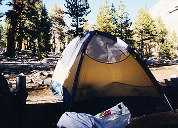
As we finished up dinner, the third member of the party finishing the JMT came by to ask if we had seen a water bottle he had dropped on the trail. I think he said his name was Bob - he looked like he was in his late 40s and stuck around to talk for a good 30 minutes or more. He told us about bears coming into camp looking up to see if there were any bear bags (i.e. free meals) - if not, they would just mosey on out. He also mentioned among other things that they were running very low on food with only two or three days until hiking out. In my mind I was thinking we could unload a lot of weight and extra food on them since we always overestimate what we'll eat on the trail and we usually have a substaintially decreased appetite than we do at home. But we were both sitting on our bear cannisters and they were so meticulously packed that it would mean extra work to unpack and repack our food before getting to bed and our hopes of getting to sleep before sunset were already dashed (since the sun set as Bob stood there talking to us). Eventually I grabbed some powerbars from our readily available stuff sack and offered him a couple. I knew, even then, that we would never finish all of our powerbars and that I REALLY ought to offer him 10 or so. He graciously accepted and thanked us and retired to his camp. We promptly cleaned up and crawled into the tent for the night. 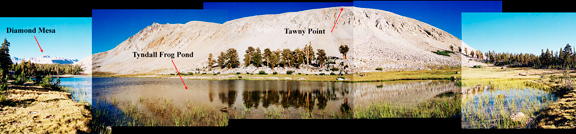
day 3: tyndall frog ponds to upper kern canyon The problem with going to sleep at 8:30 in the evening is that I usually have to get up to pee by 1:30. Most of the time I will wait until 3:30 when it is absolutely necessary and I'll wake Jeremy up to let him know I'm getting out of the tent. That morning Jeremy needed to go outside too. There was less than a half moon up - but it was very bright and illuminated the sprawling but patchy cloud cover overhead. I was startled to see this moisture move in at night and got a little nervous thinking of what it would mean for that day's weather. The typical pattern we've observed in the past has been west to east, but this time everything was headed north. We went back to sleep and by 6:00 when the sky began to brighten, the clouds had dissipated almost completely leaving only a wisp here and there. Bob and Co. came by as we packed up the tent and said thanks and good luck. Bob mentioned the clouds from early in the morning and warned of a monsoon system coming from the south based on a report he had gotten from a ranger. We exchanged good byes and they were on their way. We headed out 30 minutes later at 8:00 - a very late start, but we weren't planning to cover any passes that day. 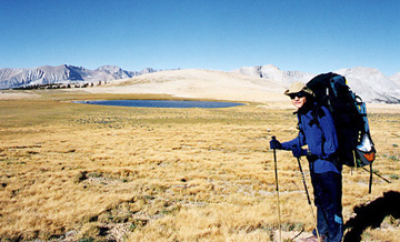
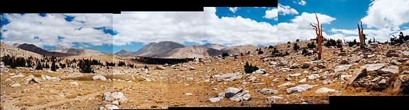
Our day was to consist mostly of descent, but the first part of the morning was spent climbing a few hundred feet to Bighorn Plateau. The scenery from the plateau is breathtaking, affording dramatic spans of the western Sierra Nevada, Kern Canyon, Tyndall Creek and Upper Tyndall Drainage. This is a picture of Jeremy at the high point near a small pond. In the distance you can see the Kaweah Ridge Range and the Kern Ridge. The wind was strong and steady. As we headed south on the JMT, the Whitney Crest came into view - the peaks looking more like part of a moonscape than the Sierra. 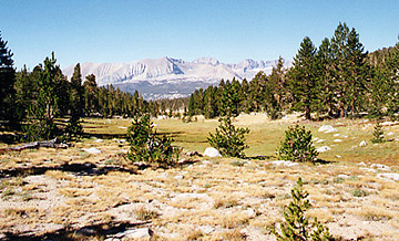
Leaving Bighorn Plateau, the trail wound in and out of many beautiful meadows nestled in small valleys. Above is one of the meadows we passed through while admiring the ridges in the background. 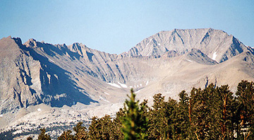
This is a telephoto of the basin east of Red Spur with Kaweah Basin behind it to the right. Kaweah basin was one of our intended destinations for the trip. I didn't realize we would be able to see it from the trail, but after wondering what that bowl was for a mile, we stopped to check the map and discovered that Kaweah basin was just beyond it. We descended to the junction with Wallace Creek and then headed west and down to Kern Canyon. There were campsites at the creek and then the trail gradually became more exposed as we rounded the arm of a large spur. It was hot under the sun, but we made good time as we reached the Kern Canyon trail. We turned south and hiked down to Junction Meadow, reaching the flat park-like area by 12:30. We ran into a group of 4 who were taking a leisurely backpack in the Sierra. They were planning to camp at Junction Meadow, but they said there was an enormous group of boyscouts that had just settled in and had taken up every last bit of space in the bear boxes. They decided to move on (they were ultimately headed for Whitney) and asked how much further Wallace Creek was. We told them what we knew and exchanged information on the weather. The temperature was well in the 80s and we took a long break for lunch. We couldn't decide whether to continue up toward Colby Pass and make our way to Kaweah Basin, or to lie low and move up Kern Canyon. A fellow wandered up to us from the south and asked if we had seen a group of four backpackers pass through. We said yes and discovered he was part of the group and that there were others to follow. We told him they were headed to Wallace Creek and he said that was out of their way. We asked where he was headed and he replied, "Whitney". He was out of water and had no filter and no map. We told him Wallace Creek was on the way to Whitney and mentioned the monsoon system moving up the state. He swore and then complained that his partners gave him gear at the last minute so he dumped his rainjacket. My facial expression didn't change but I just thought this guy was an absolute idiot. We then informed him he was also on the wrong branch of the trail and that he needed to take the right fork a few hundred feet back. Jeremy went to pump water while I applied sunblock and changed to shorts and a t-shirt. We had determined not to camp at Junction Meadow since it was still early, we had energy left and we didn't want to hang out with a bunch of obnoxious boyscouts. Either way, we would have to make a climb of about 1000 feet - but moving into the Kern Kaweah River drainage would put us further into the backcountry, whereas heading up Kern Canyon would allow us to hike out early if the need arose due to weather. I mulled over this until Jeremy arrived. He asked what I had decided and I told him I would feel better staying in Kern rather than heading toward the exposed Kaweah Basin. I felt so disappointed for bailing out on Kaweah Basin, but I was unfamiliar with how a monsoon would behave in the Sierra. If nothing came of it, there was still plenty of territory for us to explore. If weather turned ugly, we could try to cross the two passes before it got worse. Jeremy agreed and so we began the climb back up the way we had come. We passed two rangers working on the trails and asked them about weather forecasts. They hadn't heard any reports in a few days and one of them said, "Oh well - you know in the Sierra you never know what will happen next. It's crazy weather." We asked them about good places to visit and they said the valley leading to Colby Pass (the one we opted not to travel) was one of their favorites. Milestone Basin and Lake South America Basin were also high on their rating. I felt better about our options and we thanked them and continued up canyon. 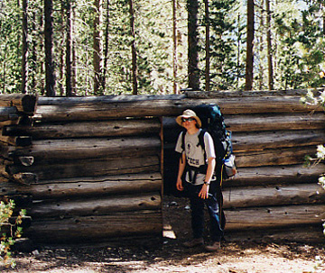
The trail was hot and dry until we reached the cover of trees and the terrain leveled off to a moderate ascent. We followed the Kern River and stopped by an old abandoned cabin. It had no roof, but it was neat to see a structure in the middle of nowhere. There were campsites nearby but we wanted to make a little more progress before making camp. 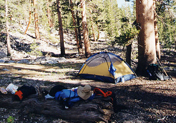
About 2.5 miles above Junction Meadow we grew tired and began looking for a clear spot for camp. After crossing Tyndall Creek, we found an area on the eastern slope that had apparently been used in the past. There were no bear boxes, but by now we had consumed enough food for everything to fit in the bear cannisters. I slept fitfully that night thinking about weather and bears wandering through camp. My midnight trip outside revealed clear skies, much to my relief. I figured that perhaps the system had died out and we would have clear weather for the rest of the trip. I began to think of new routes to explore as I drifted off to sleep.
day 4: upper kern canyon to tyndall creek junction The morning sky looked blue from where we were, but the trees obscured most of our view. We saw small wisps of clouds appear and dissipate over the canyon walls. We started hiking by 7:50 and moved up the canyon along the sandy and gently sloping trail. As we hike, I like to identify junctions or features to gauge where we are. We were supposed to come to a junction with the trail leading down from Tyndall Ranger Station - but all I saw evidence of was a small cairn and a few strategically placed stones to indicate a general direction to the east. I figured it might have been leading to good campsites, but after we had clearly passed the point where the junction might be, I mentioned it to Jeremy who hadn't even noticed the cairn. We gained elevation as we moved up the Kern and the trail steepened, affording us better visibility of the southern skies. There were puffy white cumulus clouds in the far distance to the south, but they appeared to be moving swiftly in our direction. We had tossed around the idea of taking a side trip to visit Milestone Basin, but I was wary of the approaching weather and we decided to save it for a later trip. The trail for Milestone Basin is marked in much the same way as Center Basin and Tyndall Ranger Station. Just beyond the turnoff, we filtered water after crossing the numerous slabs of granite littered with rocks for trail indicators. When we arrived at the sign indicating the spur to Lake South America, we turned to look at the skies again. The clouds were beginning to reach us and they were more dense than before. We had considered camping at Lake South America and then taking Harrison Pass down to East Lake, but if it was going to break loose overhead, then I didn't want to be caught running down a cross country route in bad weather. I told Jeremy my misgivings and he agreed that hiking out over trail we were familiar with in bad weather would probably be safer. With a heavy heart we opted to cut across to the John Muir Trail. 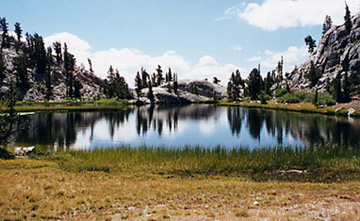
The trail wound around small granite outcrops and into and out of bowls containing tiny lakes like the one to the left. The sun was strong when clouds weren't passing in front of it and the trail grew muddy and hot in some places. I felt that our original trip plans had been totally screwed up because I was too chicken to deal with bad weather up high. What if it all cleared up and it was nothing to worry about in the first place? While these thoughts cluttered my head, the moisture continued to build up above us. Before crossing over the high point of the southwestern spur which separates the Lake South America basin from the upper Tyndall flats, we stopped for a water break and some photos. The peaks to the west were spectacular and you can see how the clouds were starting to catch up with us. Below: looking to the west and then to the east. 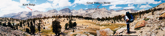
Below is a small pond right by the trail that had some waterfowl swimming about close to shore before we arrived. Many of the streambeds were dry or just damp prints where water flowed earlier in the season. People on the JMT had marveled at the good weather they had enjoyed for 3 straight weeks, and now those we had met just two days ago would be finishing on Whitney which sat under a thick blanket of dark-bottomed clouds that moment. Cumulus clouds were piling up against the high ridge of the Kings-Kern Divide like a logjam. I could see the dark pine trees below where we planned to stop and assess the weather. As we approached the junction with the JMT, we saw a mule party heading south in the distance. Once at the junction, we headed a short way south to some campsites where we could rest our feet. We encountered a tall young man solo hiking north on the Muir trail and asked if he had any recent weather reports. He squinted and said the weather does weird things all the time and that it could build and build and not do anything, or it could rain and storm like crazy. He was headed for Lake South America to count frogs for his research. 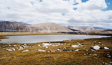
We reached the first of a handful of campsites and sat down to eat lunch around 1:50 pm. I felt chilly and Jeremy cooked one of our dinners for a warm meal. We figured since we were heading out two days ahead of schedule, we could afford to consume one of the extra dinners. An energetic group of four backpackers stopped at the campsite across the trail from us. They looked to be in their 40s and 50s - three men and one woman. The woman waved hello and we began chatting. They were also finishing the PCT, covering about 15 miles a day. They asked if there were other campsites nearby and I told them that Tyndall Frog Ponds was a pretty and more secluded place to camp if they were willing to go the extra mile. The information was passed from person to person until it became, "the pond with lots of frogs" - sort of like the game of telephone. They were from San Diego and asked where we lived. We told them we were at Cornell for graduate school in the town of Ithaca, New York. The woman (with a lovely british accent) said, "My mother was born in Ithaca!" It is a very small world. They decided to move on at which point they thanked us, wished us luck and left. A pair of female backpackers strode into camp and headed for the stream to fill water. They settled down at the campsite that was just vacated. Jeremy asked if I wanted to camp here or if I wanted to hike a few miles closer to Forester Pass and camp near one of the lakes on the plateau. The clouds were accumulating against Forest Pass and they were dark on the bottom. It looked like it would storm for sure. I said I would prefer to camp where we were and get an early start on the pass the next morning. He went to scope out other tentsites and we found a really nice one out of sight of the trail. In the photo of our tent, you can see dark clouds in the upper left corner which is right over top of Shepherd's Pass. 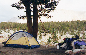
I went to go tell the two ladies that we would be getting up early in the morning and that any noises they heard weren't bears, but us. They had hiked in from Onion Valley that morning and covered about 20 miles by 2 pm. I was thoroughly impressed. They said their packs were no more than 20 lbs. each. I had to ask what they carried. Upon walking back to our camp I informed Jeremy that we had way too much stuff. It becomes a trade off - if you carry everything you need, you take longer to travel and have less flexibility. If you can travel light, then some situations can be avoided. For instance, the women told me that they only carry rain ponchos because if it is storming so badly that they need a storm jacket, they will stop hiking and pitch the tent. It all made sense, it was just a matter of what we were willing to part with. We could do this "light hiking" thing - especially on a short trip. The clouds kept piling up and they threatened on the passes all afternoon. By sunset when we were ready to goto sleep, the skies began to clear and nothing had really happened shy of a few sprinkles here and there. Our plan was to wake at 3:30 and hike by 4:30 so we could cross the pass well before typical afternoon storms might erupt. When the clouds moved out, Jeremy said he thought it looked good for the next day. I suspected the weather would build up earlier and faster the next day, which made me anxious.
day 5: tyndall creek junction to bullfrog lake We woke up at 3:30 and even though the moon was a sliver on the eastern horizon, it lit up the entire sky. Isolated clouds dotted the sky and to the south I couldn't tell if it was the same or if they covered the sky. We began hiking by headlamp at 4:40. For the first time, I was glad there was horse poop on the trail because it helped me identify the real trail from tiny spur trails. Travel was definitely slower than usual. It was warm that morning from the cloud cover. The sky lightened as we neared the final bench leading to the base of the switchbacks leading to Forester Pass. To the south, clouds formed against the Whitney Crest and to the north, they were lingering on the Kings-Kern Divide. At 6:00 we put our headlamps away. We passed a group camped at the base of the divide. They were washing hair and doing their morning wake up rituals. 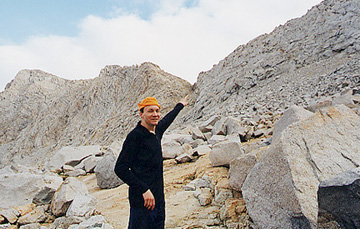
When we began to climb the switchbacks, we stopped for a break and to peel off layers of clothing. I nabbed a picture of the pass with Jeremy identifying the notch. The wide angle lens diminishes the magnitudes of the distances and heights - but the south side of Forester is an amazing trail literally blasted into the rock in some places. To the south, the cloud front was building. We reached Forester by 8:20 and the view ahead to the north looked deceptively pleasant with puffy white clouds stretched across the sky like the intro to the Simpsons. We did not remain on the pass long and headed down quickly. We encountered a couple of backpackers on their way up and warned them of the approaching front. From the north side of Forester you had no idea what was coming from the south. They asked us to inform their buddies who were camped down at lake 12,200 and to tell them to get moving. From then on I felt like Paul Revere warning all of the southbound backpackers of the coming weather system. 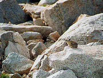
We stopped for water and to change some clothes near a boulder field (well - the whole thing was strewn with boulders) and were chirped at by a pika. There were a couple of them running around, clearly hard at work. One in particular was busily harvesting grass and rushing it to the underground den. He paused just long enough for me to snap this picture. He watched us nervously and then bounced off back to work. 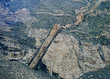
The above picture was taken just off the Kings-Kern divide because the structure caught my eye. I checked with our resident structural geologist and it looks like a dike cutting into the country rock. It was really cool looking from the trail! We passed many more parties heading up the trail who were aiming for Forester Pass. They asked about weather conditions and we told them that a storm was likely. Clouds were spilling over the pass by then, but on the Kings Canyon side it looked much less threatening. Women tended to want to talk to us more than men, but it was also because there were just more women on the trail than men at the time. Some looked prepared, others clearly were not. Rain on the pass was okay, but a thunderstorm would be scary. We stopped by some boulders for a snack and bundled up because it got cold when we weren't hiking. A man and a woman leading three llamas came up the trail. It looked as if they were carrying first aid supplies. They stopped to talk briefly and when they started up again, the man (who was in front) began to walk forward and pull on the first llama who was attached by a harness to the man's waist. He had to pull a few times before the animal moved forward - I think the llamas were happy to stop. They were really cute and seem much less temperamental than horses or mules. The clouds looked as if they were scraping their bellies on the tops of the ridges. It was awfully close. Further down the trail, we met two fellows who had been in Center Basin but didn't find any fish in the lakes and decided to head over Forester. It was just starting to sprinkle while we spoke with them. This is a picture in the direction of Forester Pass from near treeline on the northern side. 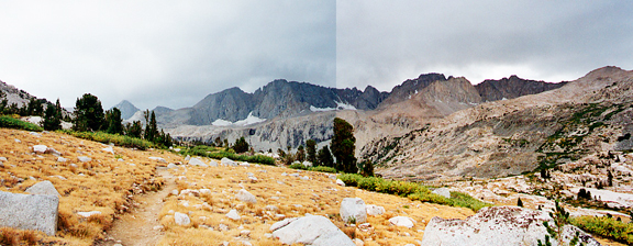
A few minutes after taking the picture there was a rush of air moving up the valley and the rain began. We decided to stop and put on rain jackets and our pack covers. Then the rain really started coming down. Clouds poured over the ridge from the south and made their way down the valley. In the near distance we heard the rumble of thunder. Small rivers of runoff flowed on the dusty, dry trail. We hiked to a campsite where we stopped to break for a snack and to filter water. In the shelter of the large pines, we found a dry spot where I bundled up in warmer clothes. Drizzle fell from the sky and occasionally a downpour would take over. A group of three young backpackers stopped at the camp on their way up. They didn't look enthusiastic about their trip. The entire sky above us was blanketed in clouds. Small wispy clouds drifted in and out of the valley and a mist settled over us. We hiked down to Vidette Meadow and decided it was still early and that we should try to get as close to Kearsarge Pass as possible today. The rain was at a steady drizzle now, though you could find completely dry spots on the trail under the enormous shelter of some old pines. I was so glad we decided to hike over Forester earlier than usual. I just wasn't sure how it would be hiking over Kearsarge the next day. We climbed up toward the Kearsarge Pinnacles and encountered a group of 20 somethings who were hiking in. They had come from Onion Valley and were caught in the storm when they crossed Kearsarge Pass. They asked what Forester was like and we gave them the report. At the turn off to Kearsarge Pass, we could see a few blue holes in the sky, but across the valley more dark clouds amassed on the ridges. We identified the general direction of East Lake (where we would have camped had we gone to Lake South America the day before). That area was catching a lot of bad weather. 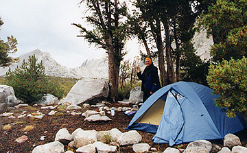
We hiked along the perimeter of Bullfrog Lake where camping is prohibited. Just beyond the lake we found a cool campsite half sheltered under leaning pines at 4:15. The Kearsarge bowl was engulfed in clouds and the distant valley we had come from was also draped in heavy moisture. We made camp and then dinner while a group of researchers measured and sampled the waters nearby in the rain. Slowly, pockets would develop in the clouds and we could glimpse patches of pink sky as the sun set. Even as the sky broke up above us, in the distance over Mt. Bago and West Vidette enormous cumulus clouds were billowing up. We agreed that packing up and hiking early would be the best plan. It didn't matter if we got soaked because we were hiking out the next day.
day 6: bullfrog lake to onion valley At 4:30 we went outside and saw that the sky was completely overcast. I crawled back into the tent and slept a little longer - not feeling terribly motivated to get going just yet. Usually on the last day, we can't wait to get on the trail, but that morning the weather was bringing me down. We began packing up our stuff at 5:30 and by 6:00 the pitter patter of rain on the rainfly began. We started hiking at 6:15 and within 15 minutes, the rain had stopped. It felt pretty warm for early morning and it was humid. We arrived at the last switchback leading across scree to Kearsarge Pass. Suddenly the rumble of thunder rose from the valleys behind us. I waited and listened. If it is long-lived, then it is aircraft (of which there are plenty flying over the Sierra, unfortunately). If it is short, it is thunder. This rumble continued, but it wasn't regular like a jet - it got loud then quiet then loud. It was a rock avalanche someplace deep in Kings Canyon. Jeremy speculated that the heavy rainfall from yesterday could have loaded an area and it just released. We took a break to change our clothes and for me to photograph the Kearsarge Pinnacles. You can see the clouds are heavier in the distance but appear to break up as they get closer. 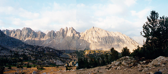
The winds picked up as we reached the pass by 8:00. The east side of the pass was sunny and bright. Clouds billowed over the pass and then evaporated into the blue sky. We met a day hiker at the pass and then continued on our way, leaving Kings Canyon and entering Inyo National Forest. It got warmer in the sun and we encountered a few backpackers and many day hikers - some with dogs. A lot of people hike up to the lakes in Onion Valley to fish for golden trout. It looked like a lot of fun. 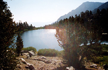
As we hiked down Onion Valley, we would recall each lake along the way. Gilbert Lake (shown to the left) was my favorite of the set because it sat right at the lip of a rocky ledge. From the view at the other end of the lake, it looked like you would plunge off the edge of the Earth if you walked past the shore. The trail was dusty and dry because the rains didn't really reach this part of the range. Someone told us that it sprinkled just a little bit the previous day, but that there were lightning strikes on a nearby peak. Whenever we stopped for water, we would watch puffy white clouds boiling over the ridge and dissipating. They seemed to make a little progress with each attempt so that when we arrived at the trailhead by 10:00, large fingers of clouds were stretching up from the mountains. 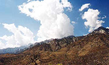
There is nothing quite like the feeling of hiking out from a backpacking trip and dropping your pack at the car. Sitting in the cushy seat of a rental car feels so good. Then stripping off boots and dirty clothes in exchange for sandals and a clean t-shirt - it feels so good! We dumped the packs in the backseat and stuffed dirty, smelly clothes in the trunk. Even with big puffy clouds overhead, the weather was deceptively sunny and pleasant. A few people asked us about the trail conditions beyond Kearsarge and were surprised to hear about the storm. It was weird to ride in the car and cover so much distance with no effort and in such a short amount of time. Coming down from Onion Valley, we were able to get a view to the south of the eastern Sierra. 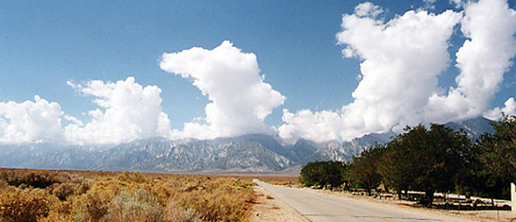
Once we reached highway 395, we turned north and followed the mountains up to the town of Bishop. Clouds were building everywhere and driving alongside Kings Canyon, we could see some beautiful peaks and valleys from the road. Each trip just gives us more hunger to explore places we haven't been. The expansive, flat Owens Valley floor is very impressive. Then the White Mountains (what Paco Gomez refers to as the REAL White Mountains) rise to the east of the Sierra as we travel further north. In town, the temperatures were hot and dry and by late afternoon we received a few sprinkles, but that was all the storm could muster over the valley. It was very dark over the mountains. Our plan was flexible and we decided to try and do a backpack with very light packs and cover more distance. We would stay the night in Bishop and drive up to Tuolumne Meadows the next day to catch more of this exciting weather. |
|
|
|
back to backpacks |
